
[This post is part of a series of posts on archaeoastronomy using open source software]
I use the free Google Earth software program to obtain satellite images of archaeological sites. If you download the Google Earth virtual globe program to your computer and start it up, in the search bar on the upper left hand side you can search for locations.
For instance, you can type “Merry Maidens UK” and it will take you to the satellite aerial view of the site. Here is a screen shot of the aerial view of the Merry Maidens that I obtained from Google Earth:
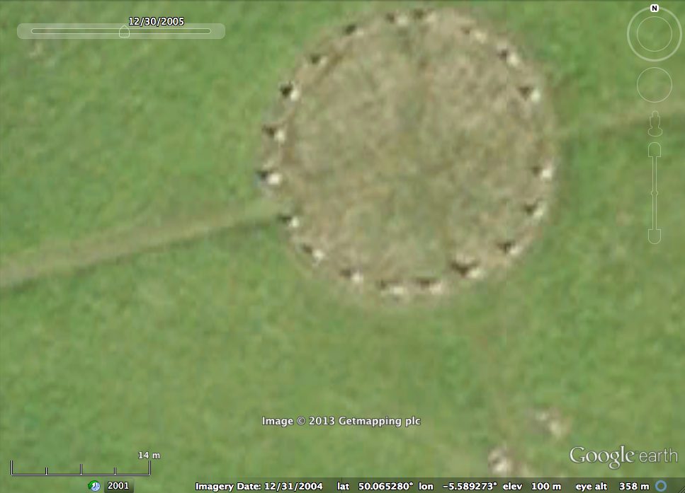
You can clearly see all 19 stones in the ring, plus the two outlier stones in the image. Whenever I obtain a satellite image of a site from Google Earth, I ensure that I include the distance scale (at the lower left hand corner) in the screen shot. This way I can determine later on in R what the true distance between all the features is.
As I will describe in the next modules, once I have the screen shot of a satellite image of a site, I can read that in to the free XFig CAD software package and place datum points on key features of the site (in this case, the stones). Then with R code, I read in the data for those datum points and fit lines between the points and determine if any of the line appear to be pointing at the rise or set of stars, the Sun, or Moon on the horizon.
At the top menu bar of Google Earth (see the screen shot at the top of this post), you’ll see a little clock with an arrow going counterclockwise. If you click on it, you’ll get a menu of past satellite images for the area. This can be very useful, since some satellite images give clearer views of the site than others due to atmospheric conditions or time of day.