[On this page I document and describe some of my work in archaeoastronomy, using mathematical, computational, and statistical methods to rigorously assess the probability that an archaeological site was used as an astronomical observatory. I will give, as an example, all the programming code and other files I used to analyze a stone circle in the UK known as the “Merry Maidens”.]
- Introduction to Archaeoastronomy
- Short overview of my free and open source software methodology applied to archaeoastronomy research
- Online application to calculate the rise and set azimuths of the Sun, Moon, and bright stars from 5000 BCE to present, given the latitude and elevation angle of horizon
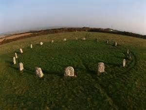
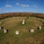
- Description of the Merry Maidens site
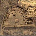
- Using Google Earth to obtain satellite imagery of archaeological sites
- Using open source software (Xfig) to establish site datum points on a satellite image
- Using the R open source statistical programming package to fit lines between datum points on a satellite image
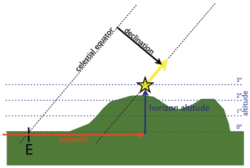
- Where on the horizon do the stars/Sun/Moon rise and set? (part I)
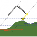
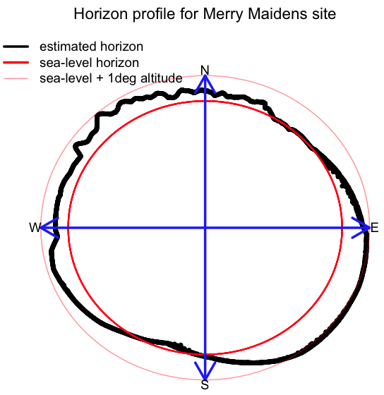
- Calculating the horizon profile using free online topographic data
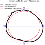
- Where on the horizon do the stars/Sun/Moon rise and set? (part II: correcting for the date a site was built)
- The folly of too many lines!

- Conclusion: was the Merry Maidens site an astronomical observatory?
- Another example
- Appendix: a compendium of formulae and sources of free data and software